Around Durness
Durness is a village in Sutherland located on the North Coast 500 (NC500). It is the most north westerly point in the British mainland. The region is quite touristy and, to discover it, we mainly used suggestions of the walkhighlands website. It details many hikes of all difficulty levels.
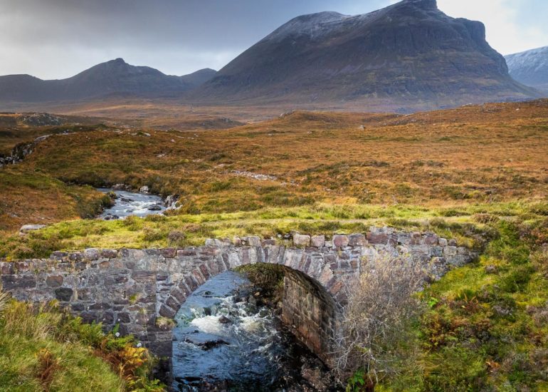
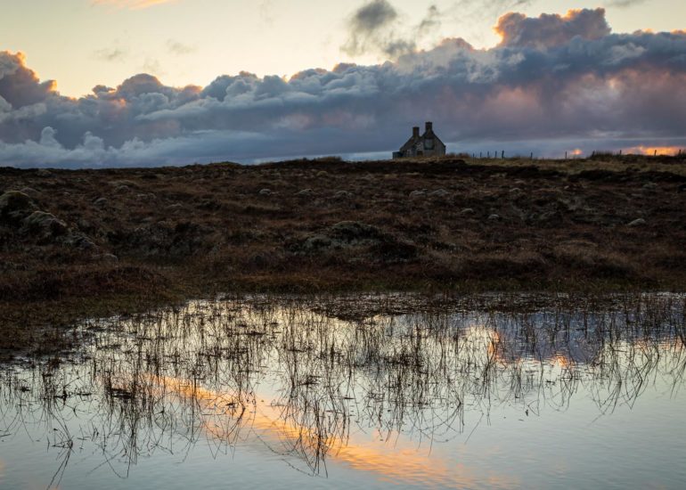
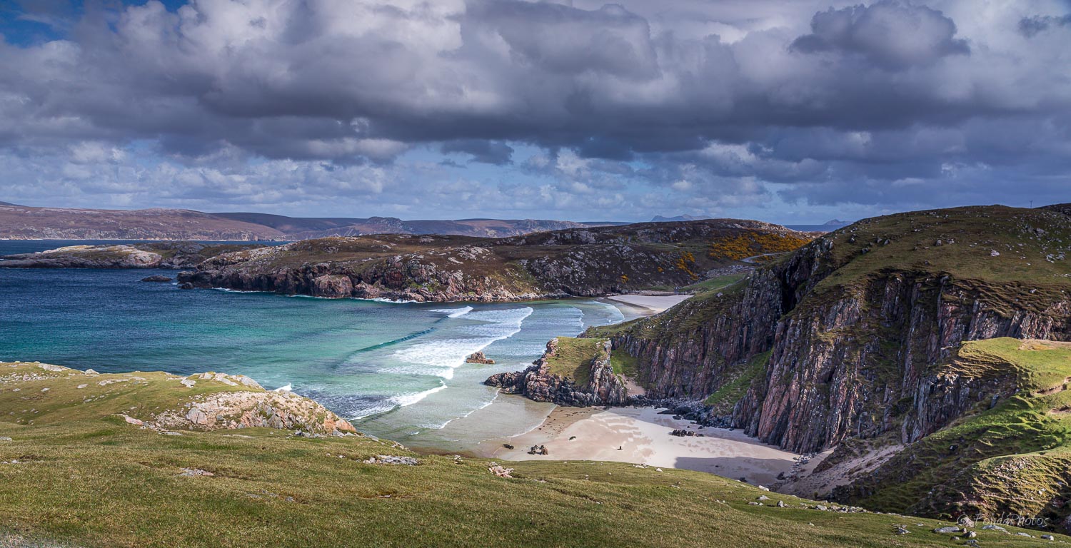
Durness is an hour’s drive west of Tongue where we lived during 3 months. The road, often a single-track road, is of unimaginable beauty, linking expansive moorlands, pristine beaches, towering cliffs, lochs with reflections of rugged mountains and dune-covered peninsulas. After crossing the Moine (largest peat-bog in Europe), the road reaches the northern end of Loch Hope then makes a big detour around the immense Loch Eriboll. Once back at the seaside, you will discover Ceannabeinne Beach at the exit of a bend. A real wonder! A few more miles and you will reach Durness.
NC500 then heads south along the Kyle of Durness towards Scourie. Cape Wrath, further west, is the site of the Cape Wrath Training Area, a military live firing range and is not accessible to private vehicles. However you can hike on the closest point, Faraid Head.
The post illustrates these places, each more beautiful than the next, with photos generally taken during weekends when we slightly departed from the containment rules in force in spring 2020.
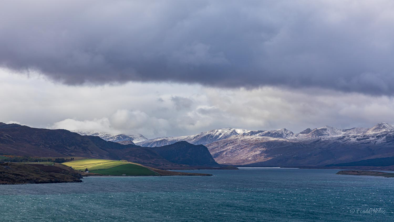
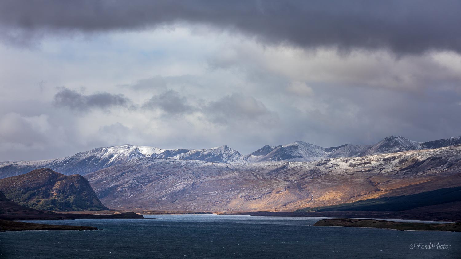
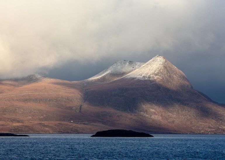
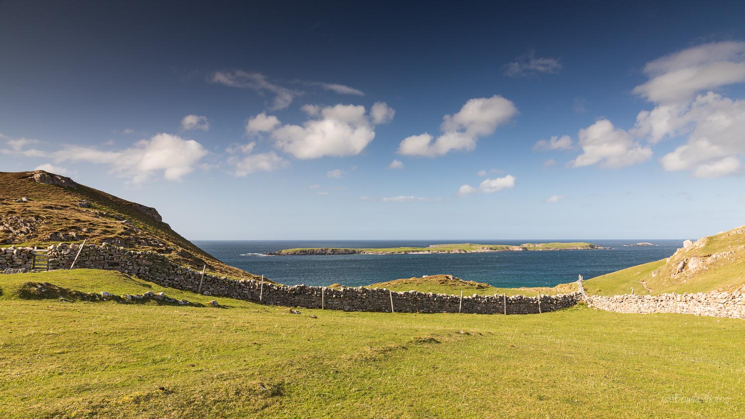
Kyle of Durness
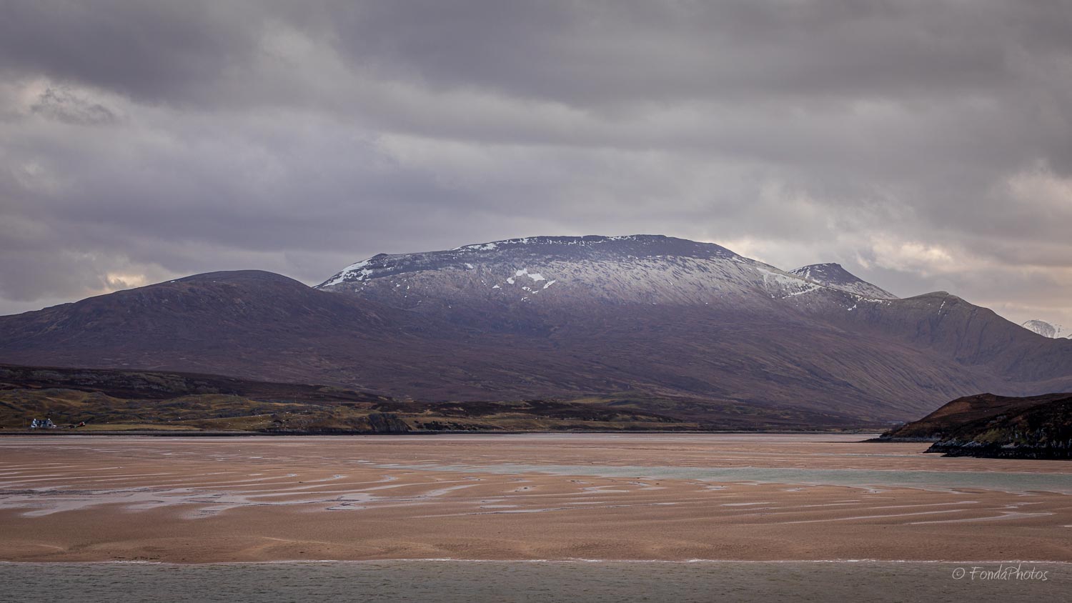
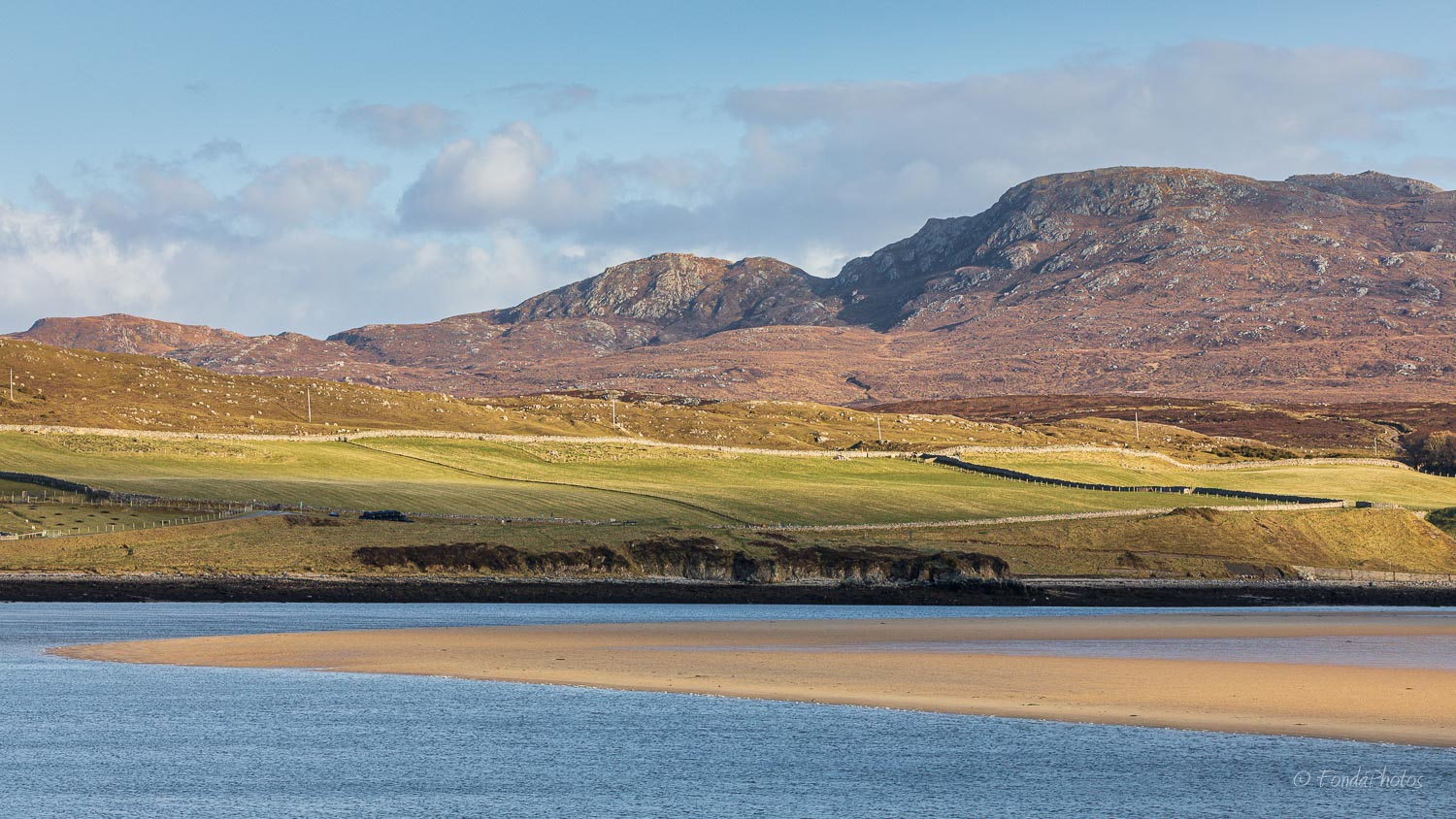
Kyle of Durness is a sea loch west of the village of Durness. It extends 5 1⁄2 miles inland from Balnakeil and divides the Cape Wrath peninsula from the mainland. I took these photos from the small dead-end road that passes by Keoldale and leads to the pier where the tiny Cape Wrath Ferry operates. The ferry sails across the Kyle where a mini-bus will drive to Cape Wrath Lighthouse. Service usually runs between May and September however, while we visited the place, it was interrupted because of COVID-19.
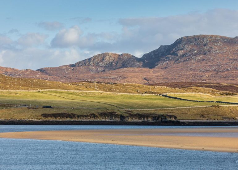
Twenty minutes apart
Looking south from the pier, the view across the Kyle is gorgeous with Foinaven and other mountains surrounding Strath Dionard emerging in the distance.

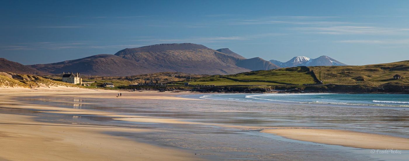
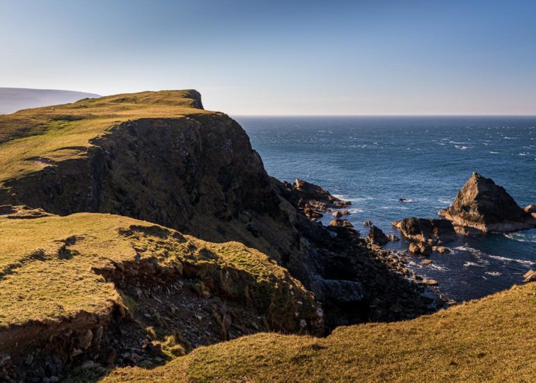
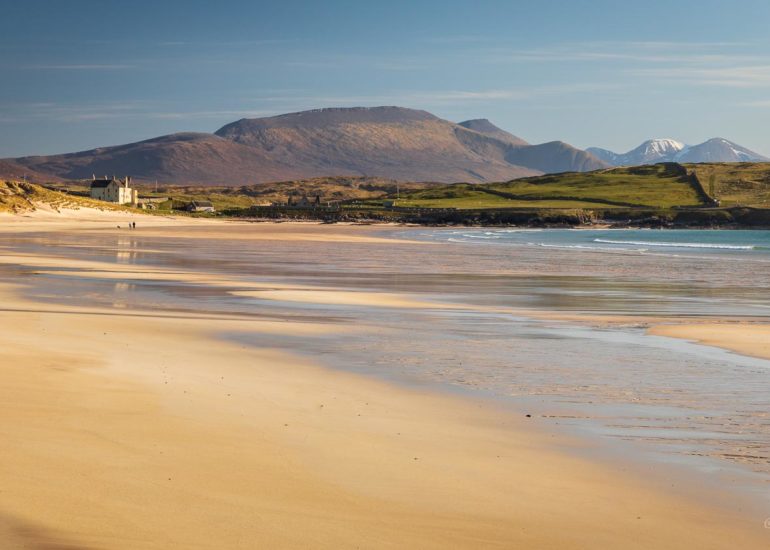
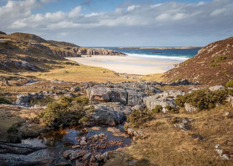
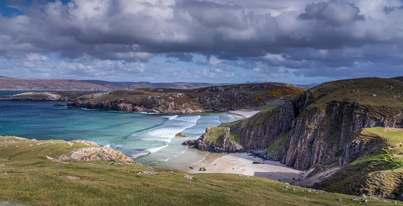
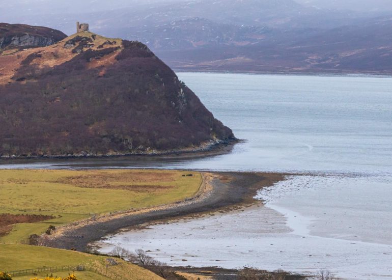
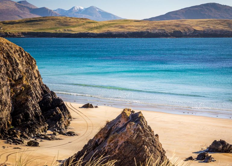
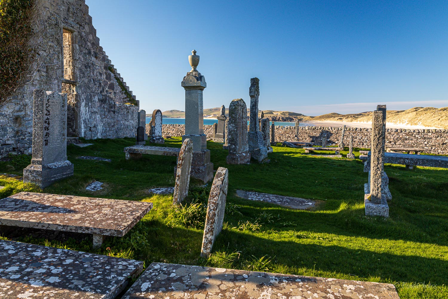
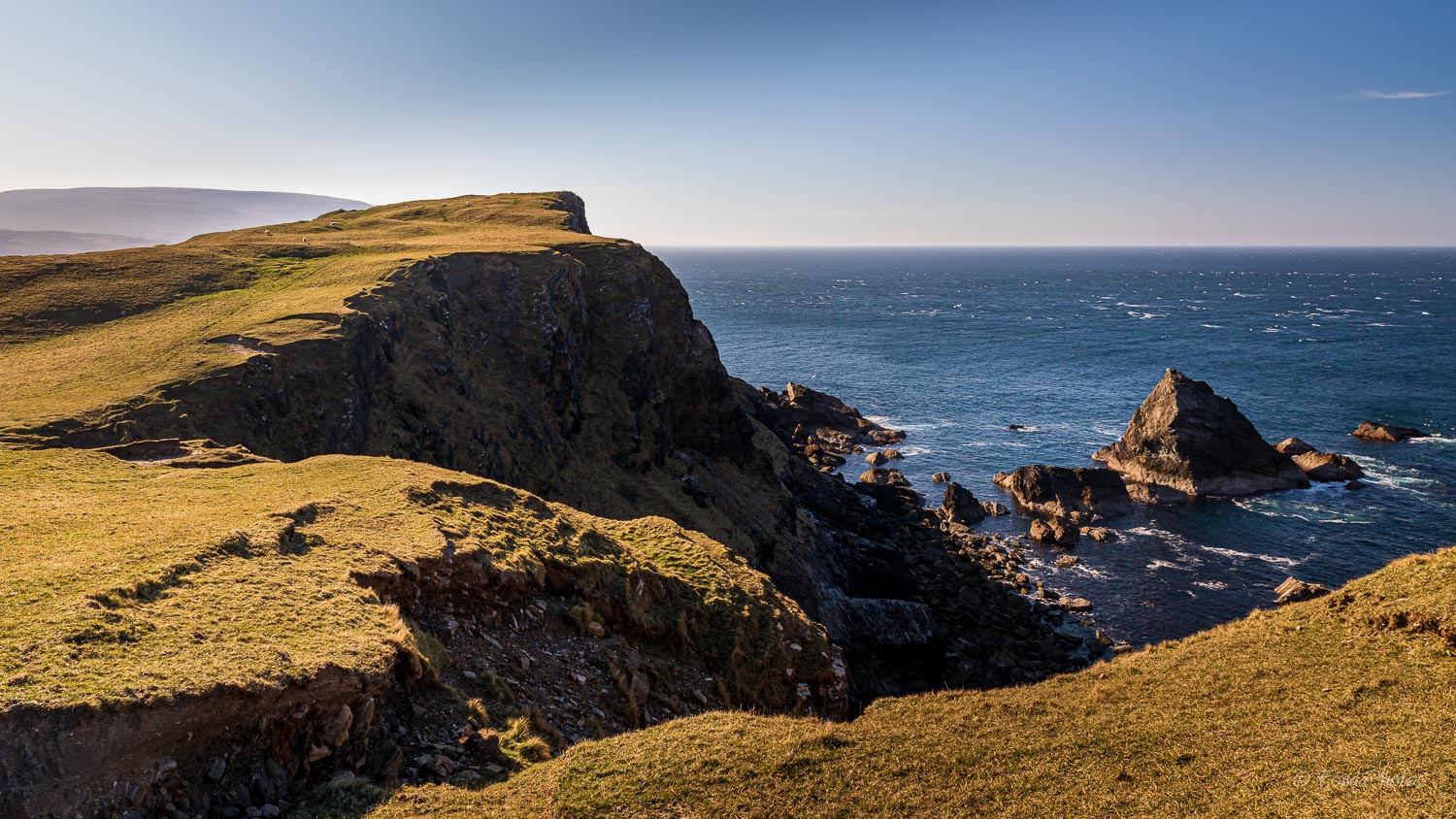
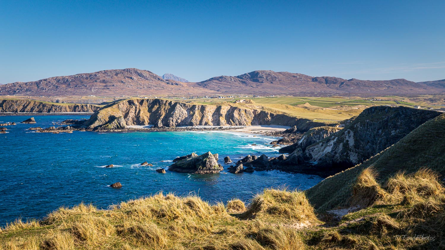
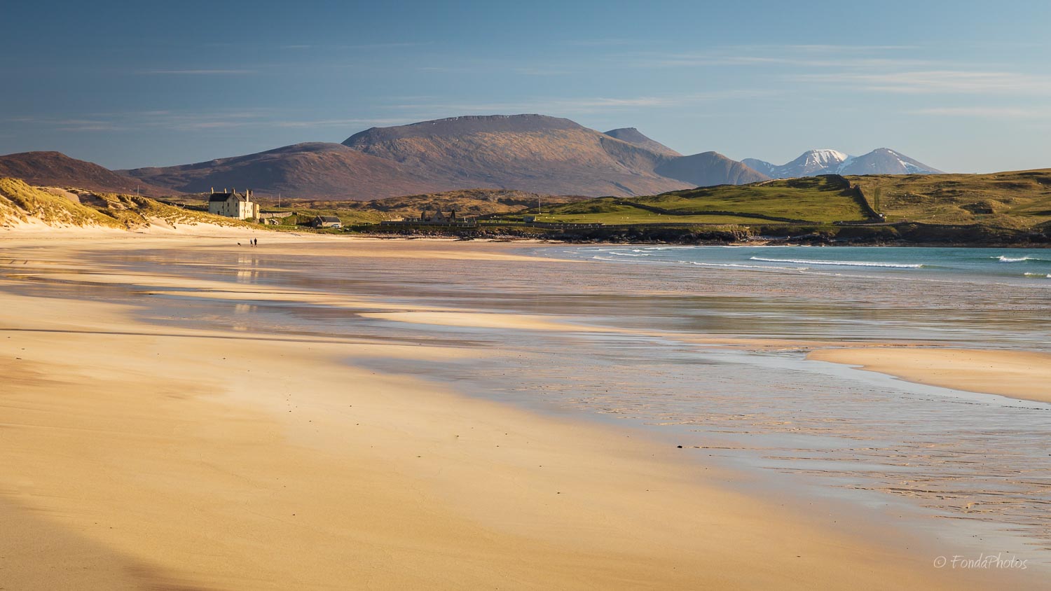
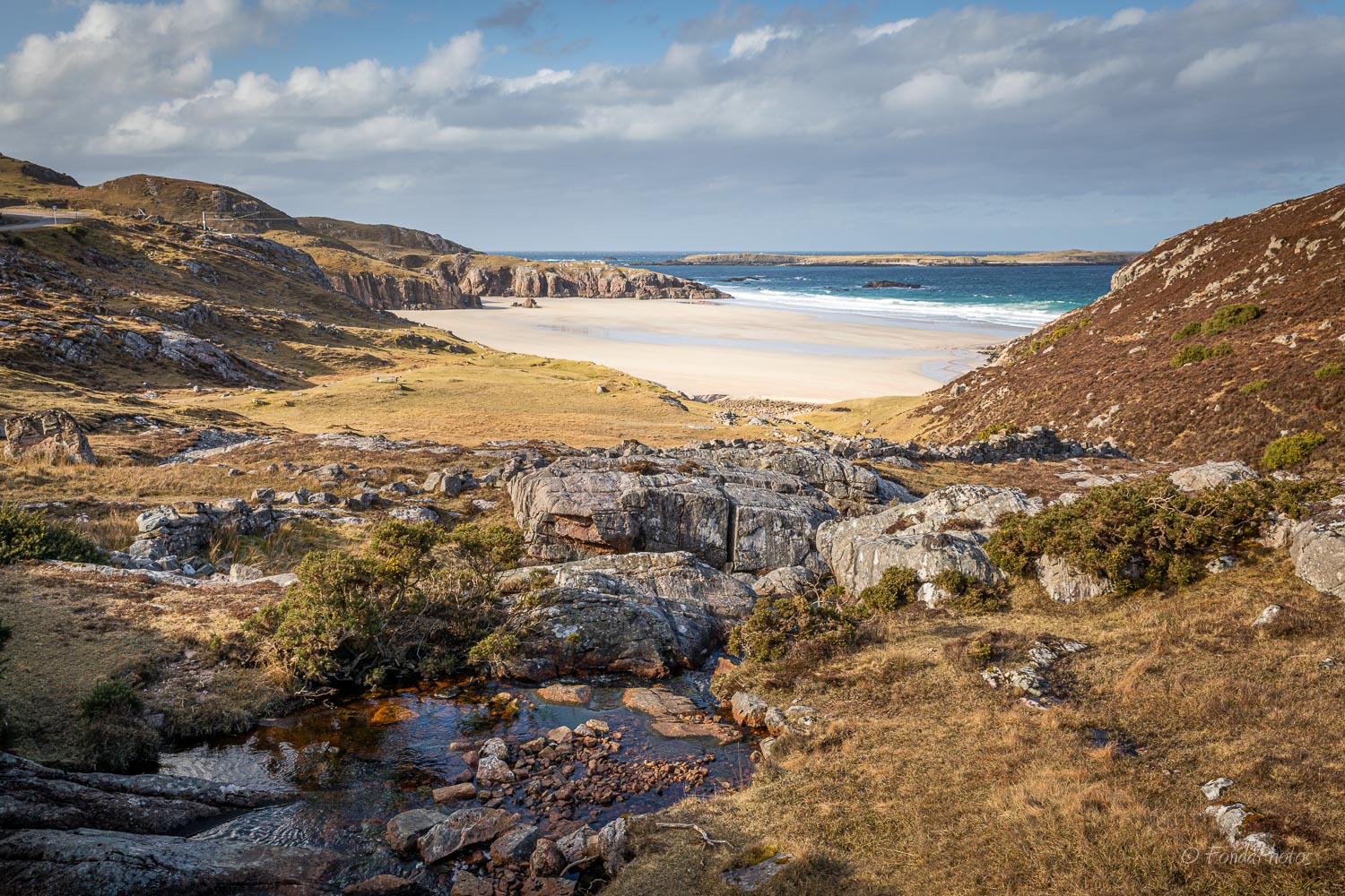
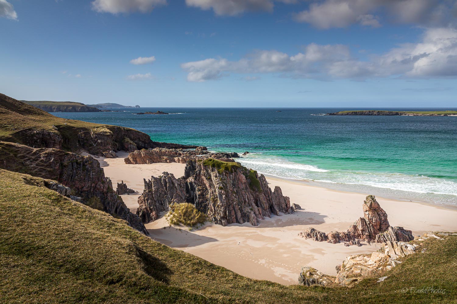
Faraid Head and Balnakeil Beach
Faraid Head is a small peninsula 3 miles north of Durness. It is mostly covered by extensive sand dunes. Because of its strategic location close to Cape Wrath, a military control tower stands at the point.
I took a long walk with my wife on Faraid Head at the end of April 2020. It begins at the ruined church in Balnakeil. From there you follow the magnificent Balnakeil beach and then cross the sand dunes towards the north. You will find many photo spots while making a loop around the peninsula. They offer a variety of views: sandy beaches, cliffs, sea stacks … On the way back, at low tide, don’t miss the reflection of Balnakeil House on the beach. This is a massive 18th century mansion located just across the ruined church and cemetery.

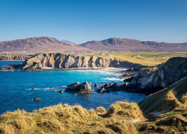
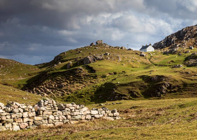
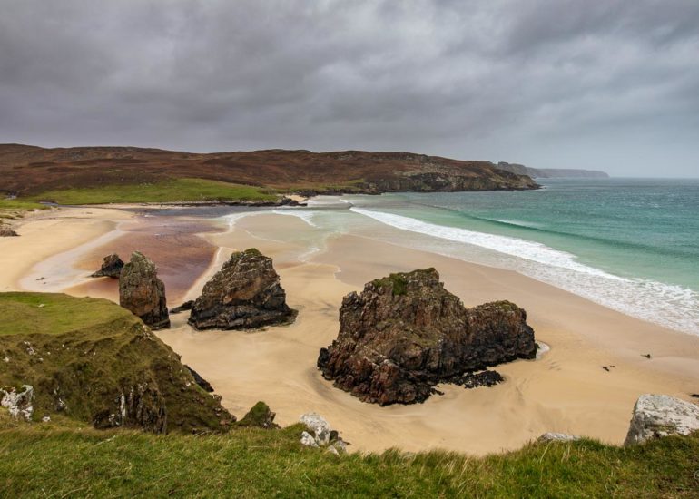
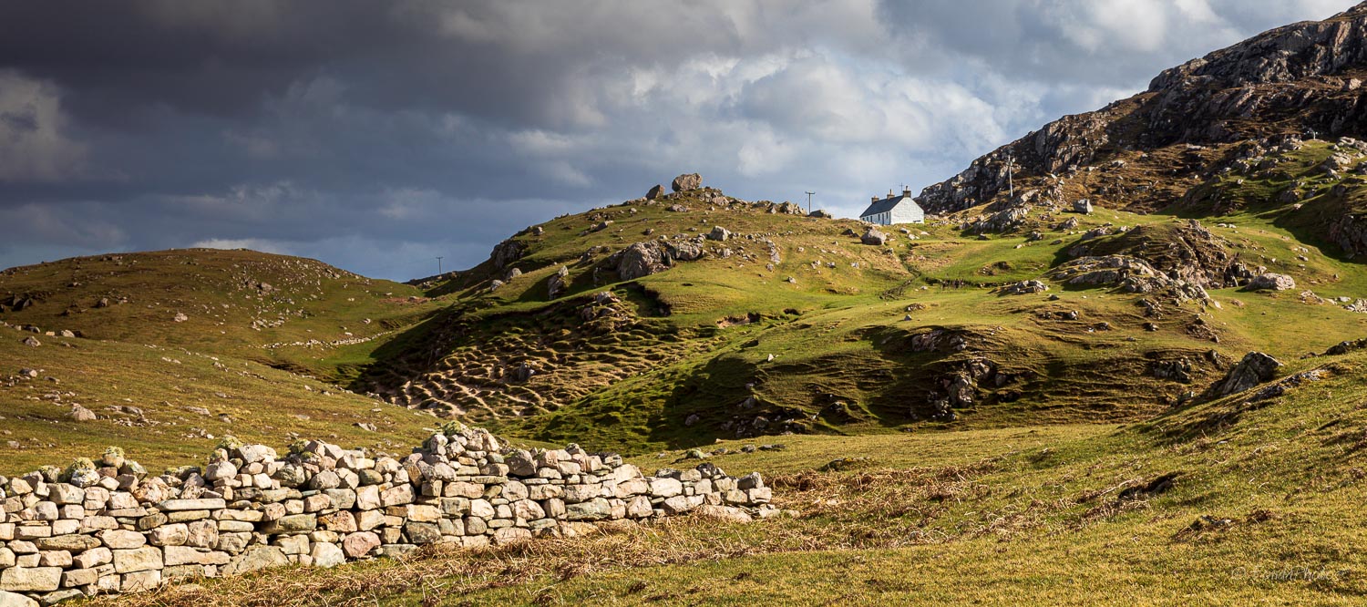
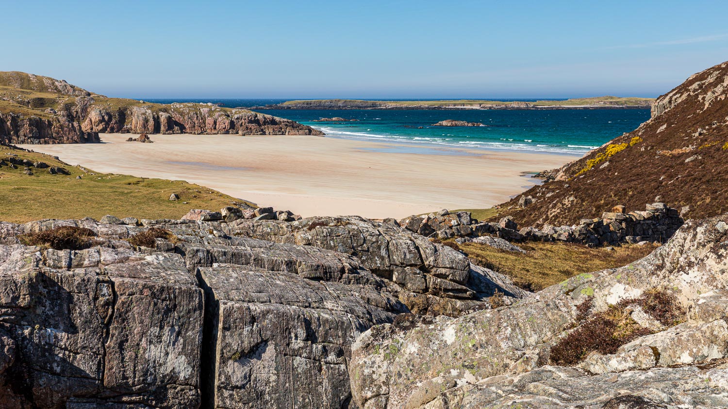
Ceannabeinne
Visiting Ceannabeinne Beach and nearby township situated on the hill above is a must while you are exploring this portion of NC500. They combine Scottish history with natural beauty!
A trail takes you around the abandoned village with scattered stones of the houses in view. This is all what is left of this hamlet where 50 people lived until 1841. By 1842 they were all cleared! This tragic episode of the Highland Clearances is well explained on the numerous information boards standing along the trail.
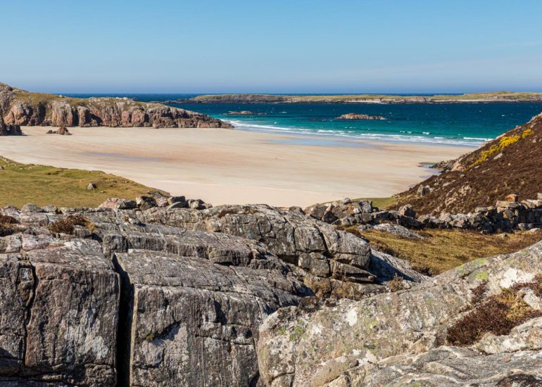
Ceannabeine Beach is located below the township, to the east. It’s a beautiful, white sandy beach with rocky outcrops and crystal clear water. Every time I was driving by on NC500 I could not resist stopping the car to take a few pics of such a beauty!
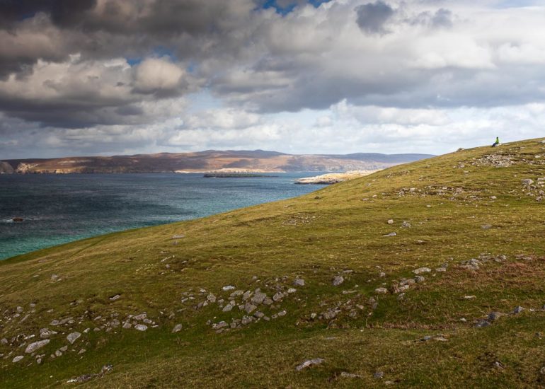

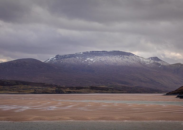
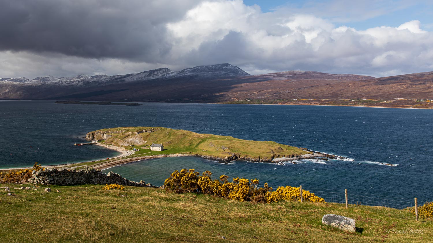
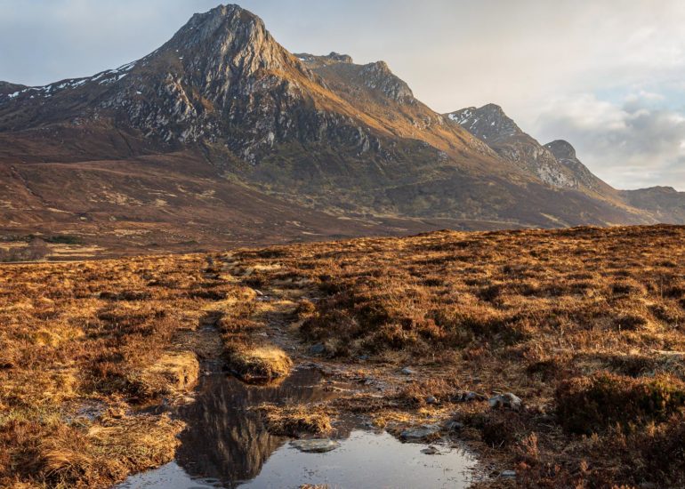
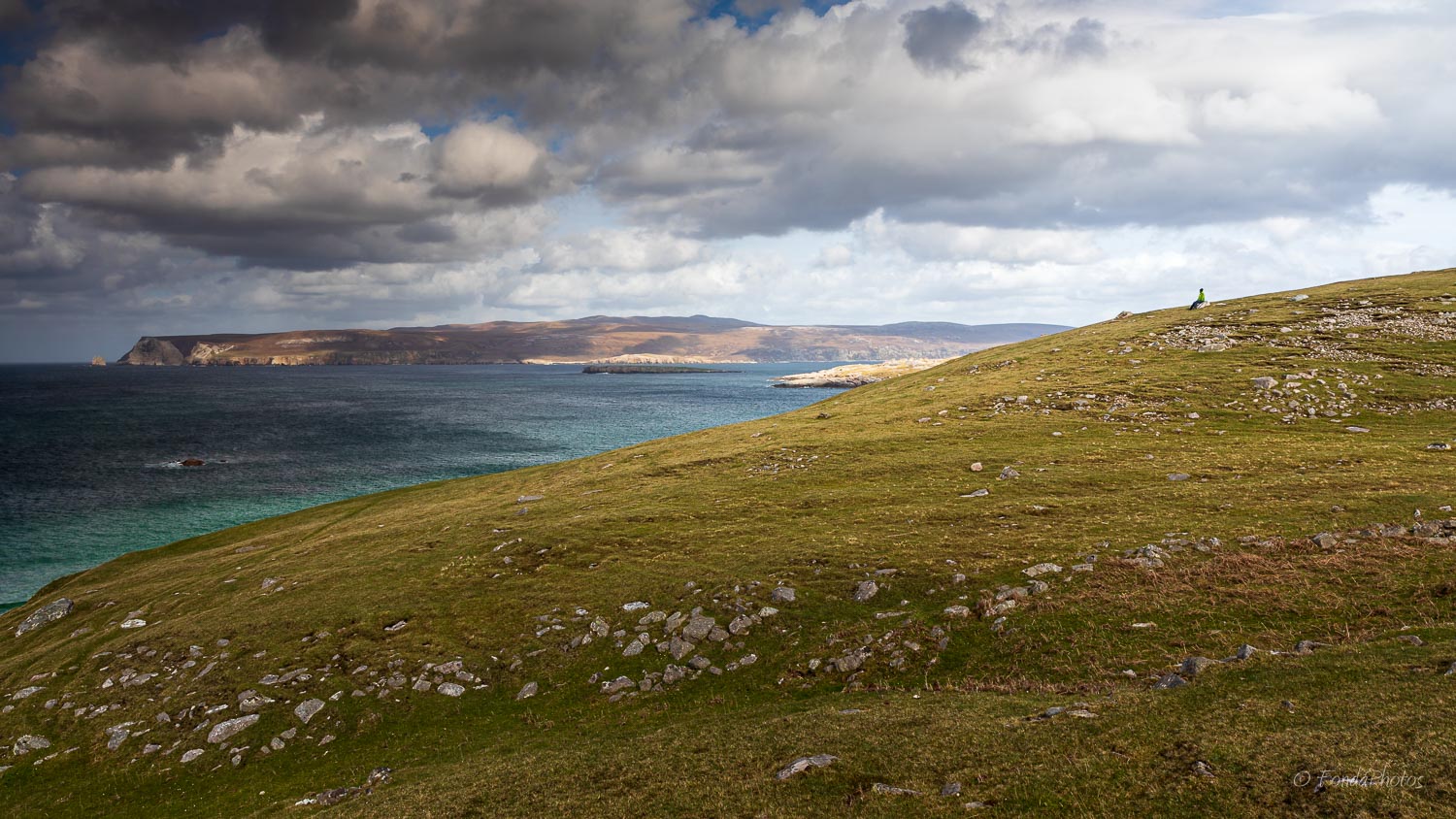
Loch Eriboll
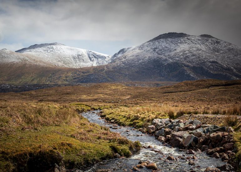
Loch Eriboll is a sea loch approximately 10 miles long located east of Durness. When you arrive from Tongue on the NC500, the road turns south then begins a descent towards the loch, offering a spectacular view! You can park a little further to enjoy the scenery. The view stretches the length of the loch towards Foinaven, a Corbett located further south. Almost at our feet, Ard Neackie, a mound connected to the coast by a sandy isthmus, offers a good foreground with its particular shape. Ard Neackie was used as the terminus of the Heilam Ferry which crossed the loch until the end of the 19th century.


